Adapting to Climate Change with Spatial Engineering
Adapting to Climate Change with Spatial Engineering
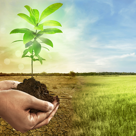
Our Challenge
Are you passionate about solving the world's biggest challenges, like climate change, food insecurity, or biodiversity loss? If you're ready to make a real difference, this is the course for you! The world needs Spatial Engineers—innovative thinkers who can bridge multiple disciplines and master the art of spatial data to tackle these wicked problems head-on. This dynamic course will empower you to become a Spatial Engineer by working on a real-world case study focused on climate change. Through a challenge-based approach, you'll not only develop an actionable plan for climate adaptation but also dive deep into the three core knowledge areas of Spatial Engineering: Spatial Information Science (SIS), Spatial Planning for Governance (SPG), and Technical Engineering (TE). Here’s what you can expect: 1. Challenge-Based Learning: Engage in a hands-on challenge that will enhance your ability to integrate knowledge across disciplines. This experience is an introduction into the learning environment of the master’s programme Spatial Engineering as well (https://www.utwente.nl/en/education/master/programmes/spatial-engineering/). 2. Core Knowledge Mastery: Choose one of the three essential pillars of Spatial Engineering (SIS, TE, or SPG) and build a strong foundation in that area, especially if it's new to you. With expert guidance you’ll choose one of the 3 core knowledge areas, and it will be one you’re not yet familiar with. Join us and start shaping a sustainable future today!
The Team
Teachers
These are the teachers you'll work with on the challenge.
Learners
Challenge providers
- Study period
- 11 November 2024 – 31 January 2025
- Study format
- Online
- Application period
- 27 August – 1 October 2024
- Credits
- 15 ECTS
- Hosting university
- University of Twente
- Topics
- Learner type
- EQF Level
Bachelor Level
Information
Value and progress
Technical Engineering: Describe cycles of nutrients, water and carbon and underlying principles
Describe cycles of nutrients, water and carbon and underlying principles such as conservation of mass and energy (Process thinking and conceptualization).
ESCO SKILLS
Spatial Information Science: Apply basic statistical methods to geographic data to gain insights
Apply basic statistical methods to geographic data to gain insights.
ESCO SKILLS
General: Identify and describe gaps in your knowledge
Identify and describe gaps in your knowledge (related to the three core knowledge domains of spatial engineering, see below)
ESCO SKILLS
General: Plan, execute and reflect on the learning process needed to bridge the gap
Plan, execute and reflect on the learning process needed to bridge the gap.
ESCO SKILLS
Technical Engineering: Apply probability density functions and concepts of correlations & regression
Apply probability density functions and concepts of correlations and regressions (Stochasticity) to estimations of relevant parameters of earth system processes.
ESCO SKILLS
Technical Engineering: Apply parameter uncertainty to make interpretations
Apply parameter uncertainty like variability, RMSE and R2, to make interpretations of outputs of models that simulate earth system processes (Parameter uncertainty).
ESCO SKILLS
General: Integrate knowledge formulating an actionable challenge using the CBL for M-SE approach
Integrate knowledge formulating an actionable challenge using the Challenge Based Learning for M-SE approach
ESCO SKILLS
Technical Engineering: Apply schematizing complex systems using existing techniques
Apply schematizing complex systems using existing techniques to capture them in equations (System thinking and model conceptualization).
ESCO SKILLS
Spatial Planning for Governance: Describe and explain theory and context of spatial planning
Theory and context - Describe the evolution of spatial planning theory and practice and how these relate to notions of sustainable development and resilience. - Explain the political, legal and institutional context of a spatial planning situation.
ESCO SKILLS
Spatial Planning for Governance: Analysis of a planning situation
Analysis of a planning situation - Analyse a given spatial planning problem/situation, identifying key stakeholders and their interests. - Describe the trade-offs between competing interests in a given spatial planning situation.
ESCO SKILLS
Spatial Planning for Governance: Recommend evaluation and future needs
Recommend evaluation and future needs - Elaborate on ways to measure to guide, monitor and evaluate the realisation of spatial plans.
ESCO SKILLS
Spatial Planning for Governance: Discuss how spatial analysis can assist
Discuss how spatial analysis can assist in anticipating future needs and emerging issues in society.
ESCO SKILLS
Spatial Planning for Governance: Advice on a planning situation
Advise on a planning situation - Develop and present a concept plan for addressing a given spatial planning situation.
ESCO SKILLS
Spatial Information Science: Conceptualize and represent the real world in digital geospatial data
Conceptualize and represent the real world in digital geospatial data.
ESCO SKILLS
Spatial Information Science: Identify and apply multiple methods in a GIS
Identify and apply methods for the exploration, analysis, integration, synthesis and presentation of digital spatial data and imagery in a geographic information system (GIS).
ESCO SKILLS
Not sure which competencies suit you?
Take our motivation scan to find learning opportunities that will help you reach your potential goal and growth.