Facing Climate Change with remote sensing
Facing Climate Change with remote sensing
Our Challenge
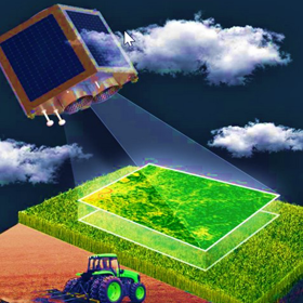
Remote sensing offers a new way of observing the Earth’s climate system with continuous and high-resolution spatial coverage through satellite-based, aircraft-based, or drone-based sensor technologies. This can significantly improve our understanding of climate change and its potential impacts at global, regional, and local scales. The data collected with remote sensing technologies can also be used to validate our climate models, improve our knowledge of the physical and dynamical processes of the climate system, and help us to project future climate change and its impacts with minimized uncertainties. This Challenge aims to plan a mission for a small satellite that is actually capable of flight that is built in one of the TUHH's Bachelor's programme. In this Challenge, addressing Master students, we will focus on: which Big Question could be answered applying an UV-sensor to the satellite? What needs to be considered once the satellite is in space?
The Team
Teachers
These are the teachers you'll work with on the challenge.
Learners
- Study period
- 14 October 2024 – 20 January 2025
- Study format
- Hybrid
- Application period
- 19 September – 9 October 2024
- Credits
- 6 ECTS
- Hosting university
- Hamburg University of Technology
- Learner type
- EQF Level
Master Level
Information
Value and progress
Work in international, interdisciplinary teams
By the end of the course students learn how to work in international, interdisciplinary teams in terms of: knowing about the different roles, reflect on team dynamics, get to know tools for efficient online collaboration and how to provide constructive peer-feedback.
ESCO SKILLS
Improve knowledge about the technical aspects of sensor system
By the end of the course students will have improved their knowledge about technical aspects of sensor systems and based on their basic knowledge explored new technical solutions to the needs.
ESCO SKILLS
Improve knowledge of the physical and dynamical processes of the climate system
By the end of the course students will be able to explore how data collected with remote sensing technologies can also be used to improve our knowledge of the physical and dynamical processes of the climate system.
ESCO SKILLS
Not sure which competencies suit you?
Take our motivation scan to find learning opportunities that will help you reach your potential goal and growth.
Hosting university
Hamburg University of Technology