
TWINEXUS
TWINEXUS
Our Challenge
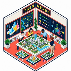
A challenge-based module in which you (the learners) build a Planning Support System to make cross-sectoral trade-offs in urban and environmental planning explicit, computable, and open to scrutiny. Urban and environmental systems are coupled across sectors: a decision in transport reshapes land value, a flood barrier redistributes risk, a change in land use alters mobility demand. These cross-sectoral externalities are the nexus the module is named for, and they are usually invisible until it is too late to act on them. TWINEXUS is a challenge-based module in which you specify, assemble, and demonstrate a Planning Support System (PSS) for an environmental planning problem of their own choosing. The module opens with a compact backbone of five methodological lectures, one per layer of the TwinNexus architecture: problem structuring, problem discretization (grids and graphs as the substrate for computation), cross-sectoral simulation, decision analysis under multiple objectives, and integration into a working decision-support tool. Land-Use Transport Interaction (LUTI) serves as the entry case: tractable enough to formalize, rich enough that optimizing one sector visibly degrades another. Teaching moves from lecture to studio quickly. You build your PSS with open-source Python tools (discrete spatial grids such as H3 or S2, spatial databases, simulation, decision analysis, and optimization libraries), so that every design choice, including the discretization of space itself, is explicit and reproducible rather than buried in a black box. The system is meant to augment a planner's reasoning, not replace their judgment: it must make a trade-off visible and defensible, not issue a verdict. Learners work individually or in small interdisciplinary teams, culminating in an oral defence in which they justify their modelling choices, not merely present them.
The Team
Teachers
These are the teachers you'll work with on the challenge.
Learners
Challenge providers

- Study period
- 3 February – 14 April 2027
- Study format
- Hybrid
- Application period
- 2 November – 2 December 2026
- Credits
- 5 ECTS
- Hosting university
- University of Twente
- Topics
- -
- Learner type
- Students
- EQF Level
Master Level
Information
Value and progress
Cross-Sectoral Simulation
Upon completion, the learner is able to formulate a planning decision as a multi-objective optimization or trade-off analysis and interpret the resulting trade-off space.
ESCO SKILLS
Planning Support System Assembly and Defence
Upon completion, the learner is able to assemble the above into a working, reproducible Planning Support System using open-source tools, and defend its modelling assumptions and limitations orally.
ESCO SKILLS
Problem Structuring
Upon completion, the learner is able to translate a planning problem into a combination of decision problems and identify relevant well-known canonical problem structures in Operations Research or comparable domains
ESCO SKILLS
Problem Discretization
Upon completion, the learner is able to translate a [supposedly] continuous urban or environmental/spatial planning problem into a discrete, computable representation (grid or graph) and justify the resolution and topology chosen.
ESCO SKILLS
Not sure which competencies suit you?
Take our motivation scan to find learning opportunities that will help you reach your potential goal and growth.
Hosting university
University of Twente

Challenge provider